Navigation
Coordinates on the Earth, the tilt of its axis, converting a direction from True to Compass, correcting for wind drift, and the calculation problems of the 1-in-60 rule and finding QDM.
This website is for educational use and initial exam preparation. Learners should verify against the official documents of their regulator and a flight instructor before real-world use. Content is based mainly on EASA standards; some figures and rules may differ from the Thai CAAT syllabus.
This is an independent educational project. It is not affiliated with, endorsed by, or connected to EASA, ICAO, CAAT, or any regulatory authority. Questions are either originally written or drawn from publicly available / openly licensed official sources (e.g. FAA public-domain material and Transport Canada's PSTAR question bank), attributed per question. They are not the live EASA or CAAT exam.
Before the GPS era, pilots found their way using only a map, a watch, and a compass. The art of navigation is turning wind, time, and direction into a route that delivers you precisely to your destination.
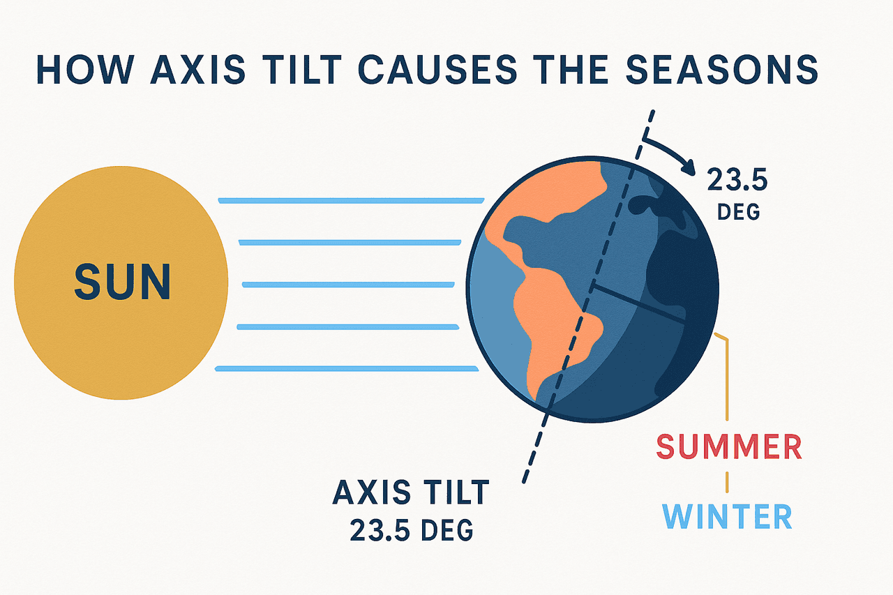
7.1 The Earth, Coordinates, and the Seasons
A position on the Earth is given by latitude and longitude, while the Earth's axis being tilted at an angle of 23.5 degrees is the cause of the seasons, including the solstices and equinoxes.
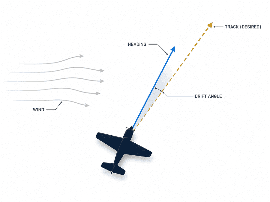
7.2 Wind and Correcting for Drift
Wind causes the direction the nose points (heading) to differ from the actual path over the ground (track). The angle between them is called drift, which the pilot must compensate for in order to reach the destination on a straight course.
7.3 Calculation Problems That Appear Often on the Exam
The 1-in-60 Rule
The principle is that for every one degree you are off course, you drift roughly one nautical mile off track after flying 60 nautical miles.
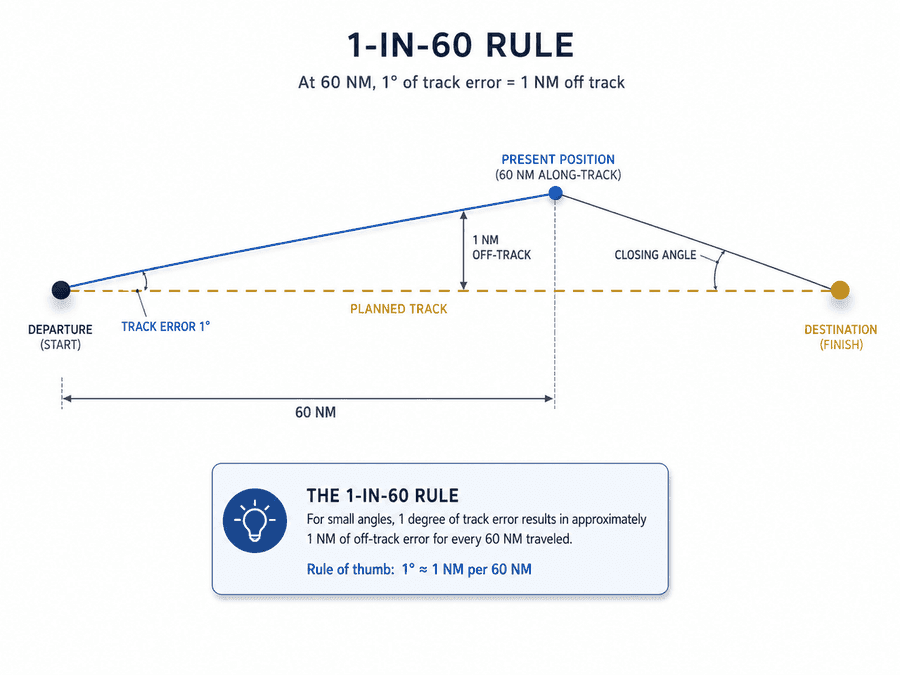
- Track Error = (distance off track ÷ distance already flown) × 60
- Closing Angle = (distance off track ÷ distance remaining) × 60
- Correction needed = Track Error + Closing Angle
Finding QDM from a Relative Bearing
The relative bearing indicator (RBI) shows the direction of an NDB station relative to the aircraft's nose. The simple formula is QDM = magnetic heading + relative bearing.
Chapter summary
The core content is coordinates on the Earth, the tilt of its axis, converting a direction from True to Compass, correcting for drift, and the calculation problems of the 1-in-60 rule and finding QDM.
Key terms
Coordinates that give a position on the Earth.
The direction the nose points / the path actually flown over the ground.
The angle between true north and magnetic north.
The magnetic bearing to fly toward an NDB station.
Being 1° off ≈ 1 nm off track per 60 nm flown.
Frequently tested points
- Converting a direction: True → Variation → Magnetic → Deviation → Compass
- drift = the difference between heading and track (caused by wind)
End-of-chapter quiz
24 questions