Meteorology
Understand clouds — especially the CB — fronts, atmospheric pressure, altimeter setting, icing, and how to read a METAR and a TAF.
This website is for educational use and initial exam preparation. Learners should verify against the official documents of their regulator and a flight instructor before real-world use. Content is based mainly on EASA standards; some figures and rules may differ from the Thai CAAT syllabus.
This is an independent educational project. It is not affiliated with, endorsed by, or connected to EASA, ICAO, CAAT, or any regulatory authority. Questions are either originally written or drawn from publicly available / openly licensed official sources (e.g. FAA public-domain material and Transport Canada's PSTAR question bank), attributed per question. They are not the live EASA or CAAT exam.
Weather is like the field a pilot has to step onto every day. On clear days it is kind; when a storm rolls in it turns cruel. The trick, therefore, is not to defeat the weather but to read its mood before you take off.
4.1 Clouds, Fronts, and Atmospheric Pressure
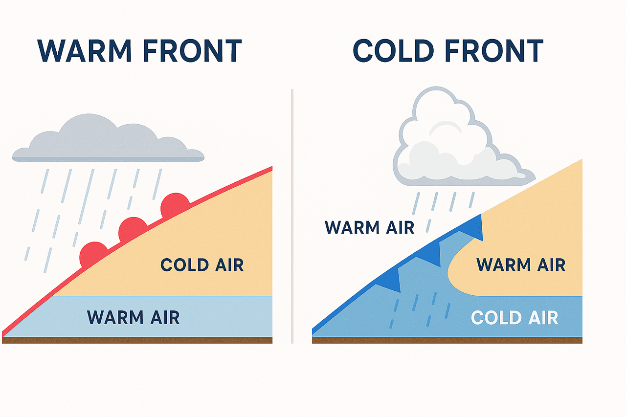
The simple rule to remember is this: stable air spreads clouds out into flat sheets (stratus), while unstable air pushes clouds to build upward, from cumulus all the way to cumulonimbus. A front is where warm and cold air masses meet, forming clouds and rain.
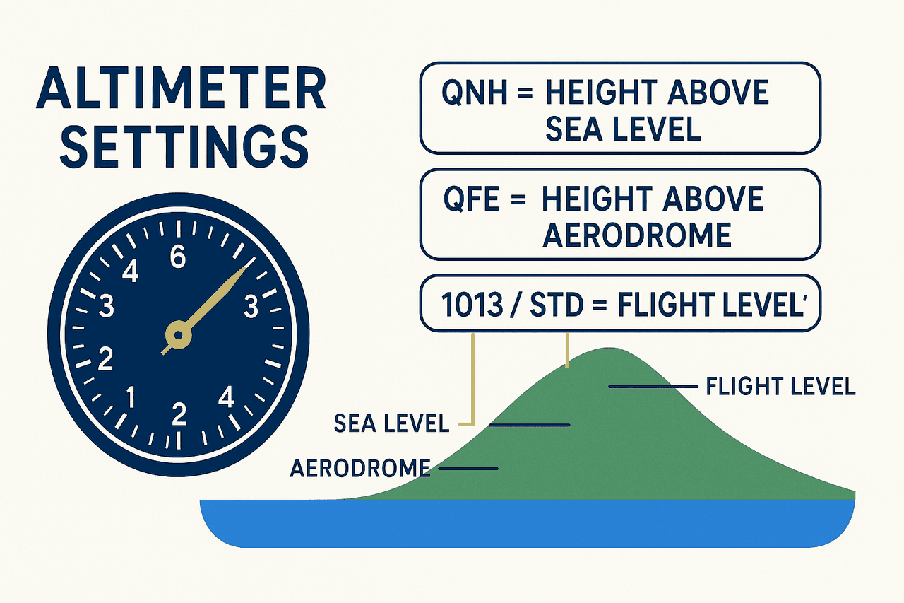
4.2 Altimeter Setting — Something You Cannot Get Wrong
The altimeter measures height from air pressure, so the reference setting must be correct. Otherwise the indicated altitude can be off from the truth by hundreds of feet.
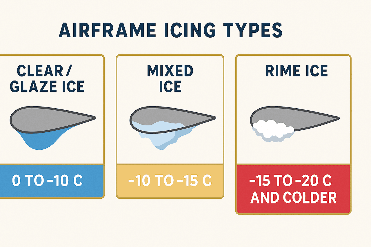
4.3 Icing and Forecasting
Airframe icing occurs when you fly through cloud containing supercooled droplets at sub-zero temperatures. Ice in the induction system (carburettor ice) is cured by applying carburettor heat.
For forecasting, there are terms you must keep apart:
- METAR — an actual weather report for right now
- TAF — a forecast ahead of time for an airfield
- VOLMET — a radio broadcast of weather reports for several airfields
Chapter summary
The core of this subject is understanding clouds — especially the CB — fronts, atmospheric pressure, altimeter setting, icing, and how to read a METAR and a TAF.
Key terms
The boundary between air masses of different temperature
The most dangerous cloud for flying
Reads height above mean sea level / reads zero at the airfield
Actual weather right now / forecast ahead of time
Water cooled below 0°C but not yet frozen, which causes icing
Frequently tested points
- CB is the most dangerous (turbulence + hail + icing + lightning)
- QFE reads zero at the airfield, QNH reads height above mean sea level
End-of-chapter quiz
16 questions